Increased seismic activity on the Big Island

We took the NCL Pride of America cruise then spent 9 days at Aulani. Every island has its own beauty and special sites. Having to miss the Big Island and Hawai’i Volcanoes National Park is disappointing but there is so much to see and do on Oahu you will wish that you had more time there. And now you have an excuse to go back!
 
Nope, unfortunately. I contacted them first thing this morning, and they stated that "vog is not covered," even if my son's pedi were to restrict him from traveling to the area. If, however, the airport were to close in coming days, resulting from, say, a steam explosion from the summit, then we MIGHT be able to get some reimbursement. Unfortunately, we will just have to sit tight and wait to see. I contacted American Airlines this morning, and they were going to charge me $3100 to make changes (basically flying into Oahu, as opposed to Kona). I only paid $3100 for my round tip tix. Soooo....as of right now, we are monitoring closely. If the air quality becomes too poor in Kona, we will change our Hawaiian Airlines interisland flight, and just leave immediately for Oahu from Kona. Sigh....I may or may not have cried to the American agent.
Are you flying into Kona or Hilo? The easiest and cheapest thing to do is land in kona, and then jump on a plane to Oahu. The Kona airport is wide open, but there are enclosed places where you could wait out of any vog. Kona is far enough away that you will probably be fine there.
 
Here is the latest uopdate from the USGS HVO Saturday, May 12 9:10 AM HST:


HAWAIIAN VOLCANO OBSERVATORY DAILY UPDATE
U.S. Geological Survey
Saturday, May 12, 2018, 9:10 AM HST (Saturday, May 12, 2018, 19:10 UTC)


KILAUEA VOLCANO (VNUM #332010)
19°25'16" N 155°17'13" W, Summit Elevation 4091 ft (1247 m)
Current Volcano Alert Level: WARNING
Current Aviation Color Code: ORANGE

Summary:

LOWER EAST RIFT ZONE
Minor spattering activity has been reported from a new fissure (16) that has opened about 0645 this morning about 1 mile northeast of fissure 15 at the northeast end of the existing vent system. No significant lava flow from this new fissure has been reported or observed at this time, but conditions could change quickly. Elevated earthquake activity and ground deformation continue and additional outbreaks in the area remain likely.

Residents in lower Puna should remain informed and heed Hawaii County Civil Defense closures, warnings, and messages (http://www.hawaiicounty.gov/active-alerts).

KILAUEA SUMMIT
Deflationary tilt at the summit of the volcano continues and seismicity remains elevated. This morning, a steady, vigorous plume of steam and variable amounts of ash is rising from the Overlook vent. Occasional rockfalls into the deep vent will produce intermittent pulses of slightly more vigorous ash emissions. Depending on wind conditions, dustings of ash may occur in the Kilauea summit area and downwind. More energetic ash emissions are possible if explosive activity commences.

This morning's trade winds are carrying the plume and ash to the southwest of the Kilauea summit. Trade wind conditions are expected to continue according to current forecasts.

Current webcam views are here: https://volcanoes.usgs.gov/volcanoes/kilauea/multimedia_webcams.html

USGS/HVO continues to monitor the situation at the summit and the lower East Rift Zone 24/7 in coordination with Hawaii County Civil Defense and other authorities. Field crews are onsite in the Leilani Estates area this morning examining the fissure vents and searching for any signs of new or resumed activity.

Please see this link for newly organized information about ash hazards, gas hazards, and the Lower East Rift Zone eruption. https://vog.ivhhn.org/

Hawaii County Civil Defense messages regarding conditions, warning, and evacuations may be found at http://www.hawaiicounty.gov/active-alerts/.

MORE INFORMATION

Activity Summary also available by phone: (808) 967-8862

Subscribe to these messages: https://volcanoes.usgs.gov/vns2/

Webcam images: https://volcanoes.usgs.gov/volcanoes/kilauea/multimedia_webcams.html

Photos/Video: https://volcanoes.usgs.gov/volcanoes/kilauea/multimedia_chronology.html

Lava Flow Maps: https://volcanoes.usgs.gov/volcanoes/kilauea/multimedia_maps.html

Definitions of terms used in update: https://volcanoes.usgs.gov/volcanoes/kilauea/extra/definitions.pdf

Overview of Kīlauea summit (Halemaʻumaʻu) and East Rift Zone (Puʻu ʻŌʻō ) eruptions:
https://volcanoes.usgs.gov/volcanoes/kilauea/extra/background.pdf

Summary of volcanic hazards from Kīlauea eruptions:
https://volcanoes.usgs.gov/volcanoes/kilauea/extra/hazards.pdf

Recent Earthquakes in Hawai'i (map and list):
https://volcanoes.usgs.gov/hvo/earthquakes/

Explanation of Volcano Alert Levels and Aviation Color Codes:
https://volcanoes.usgs.gov/activity/alertsystem/index.php
https://pubs.usgs.gov/fs/2006/3139/

CONTACT INFORMATION:

askHVO@usgs.gov

The Hawaiian Volcano Observatory is one of five volcano observatories within the U.S. Geological Survey and is responsible for monitoring volcanoes and earthquakes in Hawai`i.
 
Are you flying into Kona or Hilo? The easiest and cheapest thing to do is land in kona, and then jump on a plane to Oahu. The Kona airport is wide open, but there are enclosed places where you could wait out of any vog. Kona is far enough away that you will probably be fine there.

Thanks, buffettgirl. We are flying into Kona. We have our interisland flight to Oahu on Hawaiian Airlines scheduled for three days later; however, if things are bad, we plan to do exactly what you suggested. Gather our bags and immediately hop an interisland flight to Oahu. We are just continuing to monitor....


Here is the latest update from the USGS HVO Sunday, MAy 13 8:25 AM HST:


HAWAIIAN VOLCANO OBSERVATORY DAILY UPDATE
U.S. Geological Survey
Sunday, May 13, 2018, 8:25 AM HST (Sunday, May 13, 2018, 18:25 UTC)


KILAUEA VOLCANO (VNUM #332010)
19°25'16" N 155°17'13" W, Summit Elevation 4091 ft (1247 m)
Current Volcano Alert Level: WARNING
Current Aviation Color Code: ORANGE

Summary:

LOWER EAST RIFT ZONE
Eruption of lava continues along Kilauea Volcano's lower East Rift Zone. A new outbreak early this morning just over a half mile northeast of the end of Hinalo St. and about one half mile south of highway 132 has been confirmed. Hawaii County Civil Defense reports the outbreak is on Halekamahina Loop Road. Aerial observations of this new fissure indicate it is at least several hundreds yards long and producing spatter rising many tens of feet into the air. A slow-moving lava flow is moving away from the vent.

Elevated earthquake activity and ground deformation continue and additional outbreaks in the area remain likely.

Conditions around the erupting fissures can change very quickly. Residents in lower Puna should remain informed and heed Hawaii County Civil Defense closures, warnings, and messages (http://www.hawaiicounty.gov/active-alerts).

KILAUEA SUMMIT
Deflationary tilt at the summit of the volcano continues and seismicity remains elevated. This morning, a steady, vigorous plume of steam and occasionally minor amounts of ash is rising from the Overlook vent and drifting downwind to the southwest. As has been observed over the past several days, occasional rockfalls into the deep vent are expected produce intermittent pulses of slightly more vigorous ash emissions. Depending on wind conditions, dustings of ash may occur in the Kilauea summit area and downwind. More energetic ash emissions are possible if explosive activity commences.

Current webcam views are here: https://volcanoes.usgs.gov/volcanoes/kilauea/multimedia_webcams.html

REMARKS

USGS/HVO continues to monitor the situation at the summit and the lower East Rift Zone 24/7 in coordination with Hawaii County Civil Defense and other emergency authorities. HVO geologists are onsite in the area this morning conducting overflights, examining the fissure vent activity for significant changes, and searching for any signs of new or resumed activity.

Please see this link for newly organized information about ash hazards, gas hazards, and the Lower East Rift Zone eruption. https://vog.ivhhn.org/

Hawaii County Civil Defense messages regarding conditions, warning, and evacuations may be found at http://www.hawaiicounty.gov/active-alerts/.

MORE INFORMATION

Activity Summary also available by phone: (808) 967-8862

Subscribe to these messages: https://volcanoes.usgs.gov/vns2/

Webcam images: https://volcanoes.usgs.gov/volcanoes/kilauea/multimedia_webcams.html

Photos/Video: https://volcanoes.usgs.gov/volcanoes/kilauea/multimedia_chronology.html

Lava Flow Maps: https://volcanoes.usgs.gov/volcanoes/kilauea/multimedia_maps.html

Definitions of terms used in update: https://volcanoes.usgs.gov/volcanoes/kilauea/extra/definitions.pdf

Overview of Kīlauea summit (Halemaʻumaʻu) and East Rift Zone (Puʻu ʻŌʻō ) eruptions:
https://volcanoes.usgs.gov/volcanoes/kilauea/extra/background.pdf

Summary of volcanic hazards from Kīlauea eruptions:
https://volcanoes.usgs.gov/volcanoes/kilauea/extra/hazards.pdf

Recent Earthquakes in Hawai'i (map and list):
https://volcanoes.usgs.gov/hvo/earthquakes/

Explanation of Volcano Alert Levels and Aviation Color Codes:
https://volcanoes.usgs.gov/activity/alertsystem/index.php
https://pubs.usgs.gov/fs/2006/3139/

CONTACT INFORMATION:

askHVO@usgs.gov

The Hawaiian Volcano Observatory is one of five volcano observatories within the U.S. Geological Survey and is responsible for monitoring volcanoes and earthquakes in Hawai`i.
 
While volcanos are unpredictable, the Tradewinds on the Big Island generally blow to the southwest. The winds should keep Hilo clear, while Kona is only subject to only occasional poor air quality due to emissions blown back by ocean breezes. The entrance to the Volcano National Park is upwind on the Northeast. Even during the eruption of 1924, there are photos of people standing on the northeast rim with all the ash cloud is blowing away from the crowd to the Southwest. Due to better monitoring of the area, other dangers besides air quality are now known that would prohibit a safe visit to the rim during an eruption.

For more information about air quality see: https://vog.ivhhn.org/


-Paul


Pjacobi, Thanks for the information. So many people who haven’t visited (and some who have) don’t understand the geography of the Big Island. I always like to orient my self by becoming familiar wiht maps of the palces I am visiting.8-):thumbsup2
 
Here is the latest update from the USGS HVO Monday, May 14 8:36 AM:

HAWAIIAN VOLCANO OBSERVATORY DAILY UPDATE
U.S. Geological Survey
Monday, May 14, 2018, 8:36 AM HST (Monday, May 14, 2018, 18:36 UTC)


KILAUEA VOLCANO (VNUM #332010)
19°25'16" N 155°17'13" W, Summit Elevation 4091 ft (1247 m)
Current Volcano Alert Level: WARNING
Current Aviation Color Code: ORANGE

Summary:

LOWER EAST RIFT ZONE

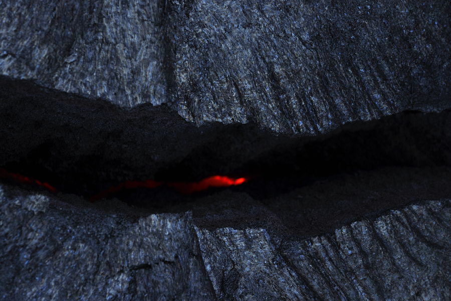
Eruption of lava continues from multiple points along the northeast end of the active fissure system. Residents in lower Puna should remain informed and heed Hawaii County Civil Defense closures, warnings, and messages (http://www.hawaiicounty.gov/active-alerts)

This morning, activity is dominated by lava fountaining, explosion of spatter more than 100 feet into the air, and an advancing lava flow from fissure 17 at the northeast end of the fissure system. As of 630 am the fissure 17 flow had traveled just under a mile roughly east-southeast parallel to the rift zone. It is turning slightly south and at this time is about one half mile south of Highway 132.

Fissure 18 that became active late yesterday is weakly active.

A fissure 19 has been spotted very near fissure 15 as of about 8 am just northeast of Pohoiki Road and north of Hinalo Street at the east end of Lanipuna Gardens. It is producing a sluggish lava flow.

Volcanic gas emissions remain elevated throughout the area downwind of the vents. Yesterday with the onset of activity at fissure 17, powerful steam jets have occurred intermittently near the west end of the fissure. These jets may be responsible for some of the loud sounds reported by residents and emergency workers.

For the most recent map showing the locations of activity, please see https://volcanoes.usgs.gov/volcanoes/kilauea/multimedia_maps.html

HVO field crews are on site tracking the lava flow as conditions allow and reporting information to Hawaii County Civil Defense.

This eruption is still evolving and additional outbreaks of lava are possible. Ground deformation continues and seismicity remains elevated in the area.

The location of future outbreaks could include areas both uprift (southwest) and downrift (northeast) of the existing fissures, or, existing fissures can be reactivated. Communities downslope of these fissures could be at risk from lava inundation. Activity can change rapidly.

Conditions around the erupting fissures can change very quickly. Residents in lower Puna should remain informed and heed Hawaii County Civil Defense closures, warnings, and messages (http://www.hawaiicounty.gov/active-alerts).

KILAUEA SUMMIT
Deflationary tilt at the summit of the volcano continues and seismicity remains elevated. Last night several strong earthquakes shook HVO and the surrounding area.

This morning, a steady, vigorous plume of steam and occasionally minor amounts of ash is rising from the Overlook vent and drifting downwind to the southwest. As has been observed over the past several days, occasional rockfalls into the deep vent are expected produce intermittent pulses of slightly more vigorous ash emissions. Depending on wind conditions, dustings of ash may occur in the Kilauea summit area and downwind. More energetic ash emissions are possible if explosive activity commences.

Current webcam views are here: https://volcanoes.usgs.gov/volcanoes/kilauea/multimedia_webcams.html

REMARKS

USGS/HVO continues to monitor the situation at the summit and the lower East Rift Zone 24/7 in coordination with Hawaii County Civil Defense and other emergency authorities. HVO geologists are onsite in the area this morning conducting overflights, examining the fissure vent activity for significant changes, and searching for any signs of new or resumed activity.

Please see this link for newly organized information about ash hazards, gas hazards, and the Lower East Rift Zone eruption. https://vog.ivhhn.org/

Hawaii County Civil Defense messages regarding conditions, warning, and evacuations may be found at http://www.hawaiicounty.gov/active-alerts/.

MORE INFORMATION

Activity Summary also available by phone: (808) 967-8862

Subscribe to these messages: https://volcanoes.usgs.gov/vns2/

Webcam images: https://volcanoes.usgs.gov/volcanoes/kilauea/multimedia_webcams.html

Photos/Video: https://volcanoes.usgs.gov/volcanoes/kilauea/multimedia_chronology.html

Lava Flow Maps: https://volcanoes.usgs.gov/volcanoes/kilauea/multimedia_maps.html

Definitions of terms used in update: https://volcanoes.usgs.gov/volcanoes/kilauea/extra/definitions.pdf

Overview of Kīlauea summit (Halemaʻumaʻu) and East Rift Zone (Puʻu ʻŌʻō ) eruptions:
https://volcanoes.usgs.gov/volcanoes/kilauea/extra/background.pdf

Summary of volcanic hazards from Kīlauea eruptions:
https://volcanoes.usgs.gov/volcanoes/kilauea/extra/hazards.pdf

Recent Earthquakes in Hawai'i (map and list):
https://volcanoes.usgs.gov/hvo/earthquakes/

Explanation of Volcano Alert Levels and Aviation Color Codes:
https://volcanoes.usgs.gov/activity/alertsystem/index.php
https://pubs.usgs.gov/fs/2006/3139/

CONTACT INFORMATION:

askHVO@usgs.gov

The Hawaiian Volcano Observatory is one of five volcano observatories within the U.S. Geological Survey and is responsible for monitoring volcanoes and earthquakes in Hawai`i.
 
Just heard that NCL’s PoA is not stopping at either Hilo or Kona and skipping the Big Island entirely this week. Last week they skipped Hilo but did anchor and tender at Kona as usual. Instead they are adding a day at Maui and will be stopping at Lahaina. The first two days are at Kahului as usual then Lahaina where they will anchor and tender passengers. The other Big Island day will be a sea day.
So sad for all the folks on the Big Island who run tours, small shops, businesses, restaurants, stalls at the farmers markets and depend on the cruise ship passengers for their livelihood. :sad1:

I saw this in today's newspaper and my first thought was that the decision was made by some executive sitting behind a desk thousands of miles away. Then I saw this picture on Instagram and thought, "yup, maybe it's a good idea to keep people off the island."

31F5FBD8-0C00-40EF-9ECE-4F4D8DCE3BB4.jpeg
 
It depends on what direction the winds blow. Several years ago all air traffic was halted in the United Kingdom and parts of Northern Europe because of ash blowing eastward from a volcano in Iceland. Volcanic ash can be sucked into the jet engines causing them to fail and the plane to crash. The current ‘Aviation Red Alert’ issued by the USGS HVO is for air traffic around Kilauea. So helicopter flyovers etc. could be dangerous. :scared:
If the wind changes and the ash flow from the eruption gets bigger then it could possibly affect air travel to Oahu. But remember Oahu is north and slightly west of the island of Hawaii and the prevailing tradewinds are blowing from east to west so the ash cloud is not heading toward Oahu.
Check the USGS website http//:volcanoes.usgs.gov. You can also sign up for alerts from all the USGS volcano observatories. (The science geek in me just loves to get the updates.) :rolleyes1:rolleyes:
Currently the USGS Hawaiian Volcano Observatory is posting status updates at least twice a day with significant changes such as the elevation of the aviation alert from orange to red as soon as it happens.
 
USGS reports that a 2 foot rock was found in Volcanoes National Park parking lot.

Rocks usually don't just fall out of the air... except at VNP!

Image the dent in your car... or you head.


-Paul
 
I saw this in today's newspaper and my first thought was that the decision was made by some executive sitting behind a desk thousands of miles away. Then I saw this picture on Instagram and thought, "yup, maybe it's a good idea to keep people off the island."

Looking back at my pictures and it has really sunk in how much danger I put myself and family in, but wow it was amazing!

I didn't stand in a crevice, but I did stand over one with active lava flowing just a few feet down.
DSC_9034e.jpg


And the lava was moving slow, but as the sun set it was difficult to see the recently cooled lava vs lava that was safe to walk upon.
DSC_9127e.jpg
 
pjacobi, That’s what the USGS has been talking about all week. The danger of large projectiles being tosed up from the vent and landing away from the crater. They take samples and measure rocks, ash and other outfall to help determine what is happening. (I am learning all this from the USGS site and they also have some great videos on YouTube.)


kdonnel, Yikes! That lava is not really cooled. Going from 2000 degrees to local air temperature takes a very long time!
I know someone who was hiking on ‘safe’ recently cooled lava with her family. She looked down to discover that the thick soles of her sneakers were melting! (How are your sneakers?)
When we were on the PoA we sailed by the lava flowing into the ocean. I heard a few people whining because the ship didn’t go closer to the lava flow. Hmmm. Lava at about 2000 degerres flowing into teh ocean and forming new ‘rock’ that you can’t tell where the sea floor is changing. Yup I trust the captain to steer clear of any obstacles.
 

GET A DISNEY VACATION QUOTE

Dreams Unlimited Travel is committed to providing you with the very best vacation planning experience possible. Our Vacation Planners are experts and will share their honest advice to help you have a magical vacation.

Let us help you with your next Disney Vacation!


facebook twitter
Top